

Research HighlightsGaining irrigation knowledge through soil sensor technology
By Carol Brown
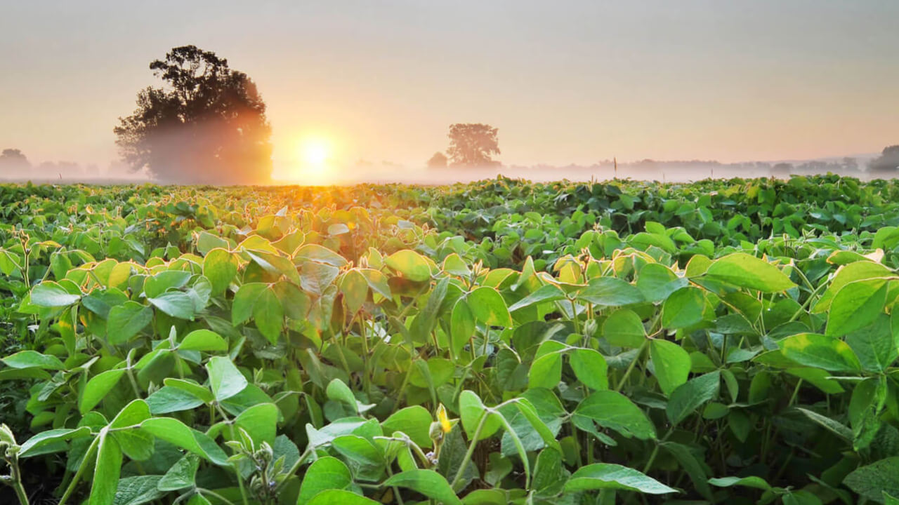
The state of Mississippi seems synonymous with water. The Mississippi River borders the state on the west and its western counties are home to the Mississippi Delta, not to be confused with the more well-known delta at the mouth of the mighty river some 300 miles south in Louisiana.
“Mississippi gets a lot of rainfall on average each year, but 70 percent of it is received in the fall and winter, not when we’re growing a crop,” said Mary Love Tagert, agricultural and biological engineering professor at Mississippi State University. “Since the 1970s, there’s been an expansion of irrigation in the southeastern United States, especially in Arkansas, Missouri and Mississippi.”
In the Mississippi Delta, irrigation can be done fairly easily. The topography is flat, on a flood plain, and the shallow Mississippi alluvial aquifer is reasonably accessible, Tagert said. But further east, where it has been historically dry-land ag production, irrigation can be more difficult.
“In the northeastern part of the state, where I’m conducting my research, there’s no shallow aquifer that can be accessed. You might drill a well 600-feet deep and still may not find water, which is not cost-efficient. So, a lot of farmers in the area are putting in surface water irrigation systems,” Tagert said.
But if farmers are irrigating from a surface water pond with no groundwater well as a back-up, presumably there is a finite amount of water to use for the entire growing season. Farmers need to know that whatever the capacity they have in their retention pond will be enough to last through the growing season, said Tagert.
Exploring irrigation efficiency
Through funding support from the Mississippi Soybean Promotion Board, Tagert and her colleagures are exploring how to use irrigation water as efficiently as possible, which includes finding accurate ways to know when to irrigate. Using in-ground soil moisture sensors, irrigation can be better controlled as opposed to guessing, she said.
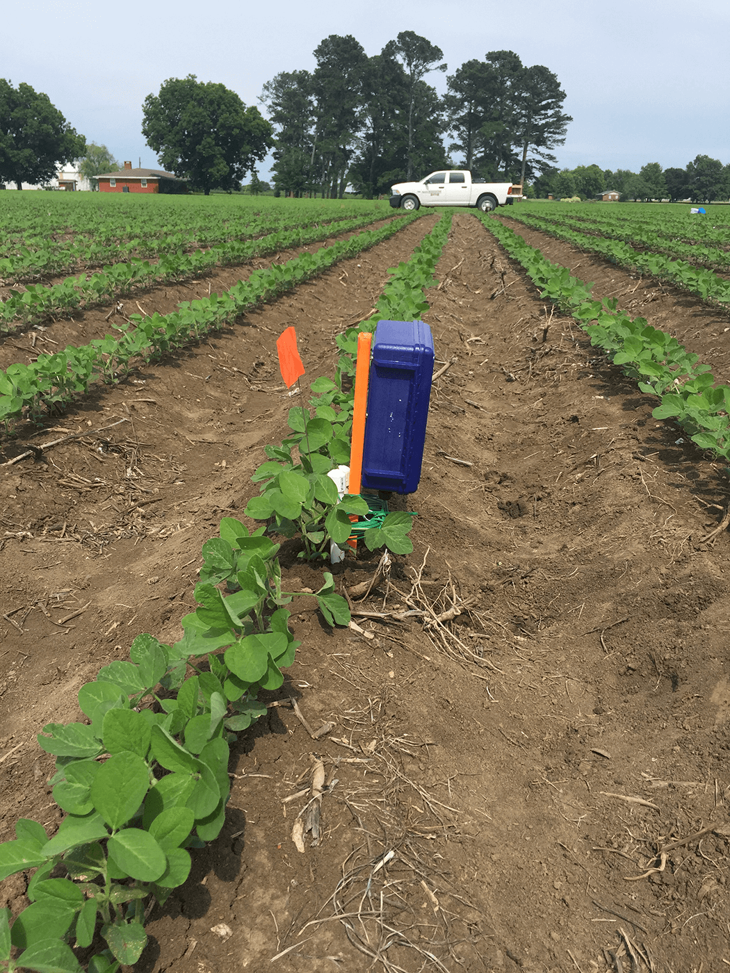
Tagert’s research entails using Watermark granular matrix soil moisture sensors, which measures the tension between the soil particles and the water in the soil.
“If you look at the recommendations on how many soil moisture sensors are needed over a given area, there’s no clear answer,” Tagert said. “We hope this research project will get a step closer to finding a clear answer.”
She has seen recommendations for a set of sensors every 10 to 15 acres and other recommendations for a set for every 100 acres. To develop more accurate recommendations for northeastern Mississippi, Tagert created a 55-square-meter grid over a production field in the region that uses a center pivot irrigation system. They installed a set of sensors for every 55-square-meter block, which is 44 points for data collection on that field.
“If we say we’re going to use one set of sensors for an 80-acre field, is that good enough?” asked Tagert. “Does that capture the variability of moisture levels in the field and even if there is variability, is it enough to trigger different irrigation schedules? If we see enough variability, maybe we take a closer look at precision irrigation.”
They placed the sensors at depths of 12 and 24 inches for soybeans and added a sensor at 30-inches for corn. The sensors need to be at the same levels as the plant roots to ensure measurements are taken through the crop’s rooting zone.
“The crops are pulling water through the entire rooting zone, so if your soil sensor is only at 12-inches and the corn root is pulling water from 30-inches, the irrigation indicators won’t be accurate,” said Tagert.
Value to farmers
Tagert sees this project as an opportunity for farmers who are just beginning to irrigate to get them started on the right path.
Dale Weaver has been using pivot irrigation on his farm in Noxubee County for nearly 10 years where he grows corn, soybeans and cotton. He has used the Watermark sensors for several years and Tagert used Weaver’s fields for her research.
“We’re fairly new to irrigation. Some of our neighbors have been irrigating for more than 20 years,” Weaver said. “I feel the soil moisture sensors are a very useful tool, especially for someone who is green on irrigation. The sensors provide a good idea of what’s going on down at the crop root level.”
He attended seminars for using the sensors and heard researchers say they were using half to two-thirds of the water than before and getting yields just as good or maybe better. He is grateful to learn of the sensor technology and plans to purchase his own units because of the research.
Other irrigation indicators
Using the data collected from the soil moisture sensors, Tagert is looking at its correlation with plant height and leaf area index.
“If we could find a connection between soil moisture and plant height or leaf area index, that might mean a cheaper, more efficient way to estimate soil moisture over a large area,” Tagert said.
This research compares aerial imagery of soybean fields to the root zone soil moisture, plant height and leaf area through measured values and those estimated using the imagery. Soil type is also taken into consideration. Crop modeling will then be used to determine an irrigation schedule for each grid point to show whether the in-field variability is enough to warrant a different irrigation schedule for different parts of the field. This will be the focus next growing season, the final year of the three-year project.
Other resources:
Video on installing the soil moisture sensors
Article in Irrigation Today, Fall 2019, pp. 6-7
Published: Dec 18, 2019


