

Research HighlightsBasic Drones Can Effectively Identify Crop Variance
By Laura Temple
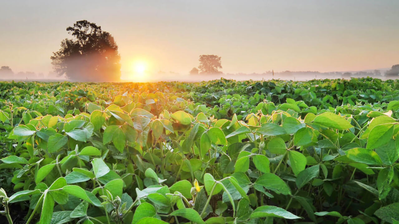
Interest continues to grow in using unmanned aerial vehicles (UAVs), commonly called drones, as a scouting tool. However, the cost of drone packages and custom software for agriculture can be a barrier for many farmers.
“Drones can map fields for specific issues, but they are often needed to simply see what is happening,” explains Randy Price, associate professor in the Department of Biological and Agricultural Engineering, Louisiana State University AgCenter. “Farmers have shared examples of drone use to monitor things that can be seen with the naked eye. However, that scouting is more efficient — and comfortable — using a drone that can quickly fly to distant areas of fields.”
Based on many such conversations with farmers, Price is leading a research project funded by the Louisiana Soybean and Grain Research and Promotion Board to learn if lower-cost drones can meet the scouting notes of most farmers.
“There are basically two classes of drones, based on camera type,” he says. “Specialized drones for agriculture use custom cameras, can cost thousands of dollars and be hard to use. However, the basic drones available at big box retail stores use basic digital cameras, can cost less than $1,000, have long flight lives and be more user-friendly than specialized packages.”
Ag-specific drones often take pictures using near-infrared (NIR) cameras, converting images to maps showing the normalized difference vegetative index, or NDVI. These maps show plant health based on known plant health indicators.
In contrast, lower-cost drones use cameras that take standard pictures in normal light, red, green and blue, or RGB.
“Our research has found that using basic software to process RGB images to show the green band minus the red band leads to results as good as NDVI images,” he explains. “Chlorophyll in plant leaves absorbs red light best, so measuring that color in the image provides a comparison of plant health. Typically, less red equates to healthier plants.”
The development of software to translate RGB images into a green minus red vegetative index (GRVI) shows small differences in crops if evaluated correctly. Price believes that lower-cost RGB camera drones, plus the software his team is developing, will provide most farmers the tools needed to effectively use drones as a scouting tool.
Standard retail drones offer advantages for farmers beyond cost efficiency.
“RGB cameras can be used for more than just mapping crops,” Price notes. “They can check distant fence lines or irrigation pivots, reveal insect movement for planning spot spraying, and essentially act as eyes on hard-to-reach areas of a farm. In addition, we’ve found that drone models made for general public use are fairly rugged, and responses to mechanical issues with previous models can be addressed more quickly and thoroughly because of the volume of sales.”
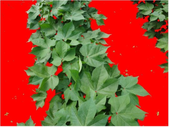
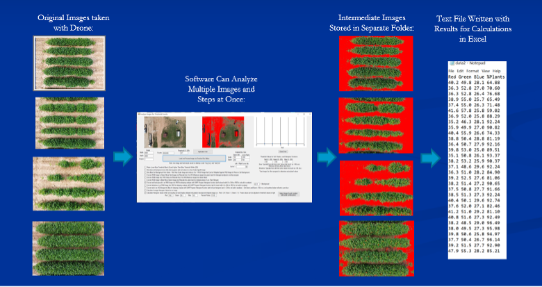
Regardless of camera type, Price notes that shadows, soil, previous crop residue and other factors in fields can impact image quality. His team is developing simple software that strips out that background to make it easier to see what is happening to plants.
“The concept is similar to the ‘green screen’ commonly used in video production,” he says. “But to see variation in plants, our team decided that a red background makes it easier to see what is happening to plants.”
The goal is to offer the background-stripping program free to farmers. They are also developing ways to effectively analyze GRVI data to support decision making in crops. Another long-term goal is using drones to spot spray.
“Our toolbox of resources should eventually help farmers detect nutrient deficiencies, identify insect and disease damage, and analyze multiple plots or fields,” Price says. “We believe we can remove cost and complexity as barriers to drone use, making this technology more accessible to farmers”
Published: Oct 25, 2021


